Trail Routes

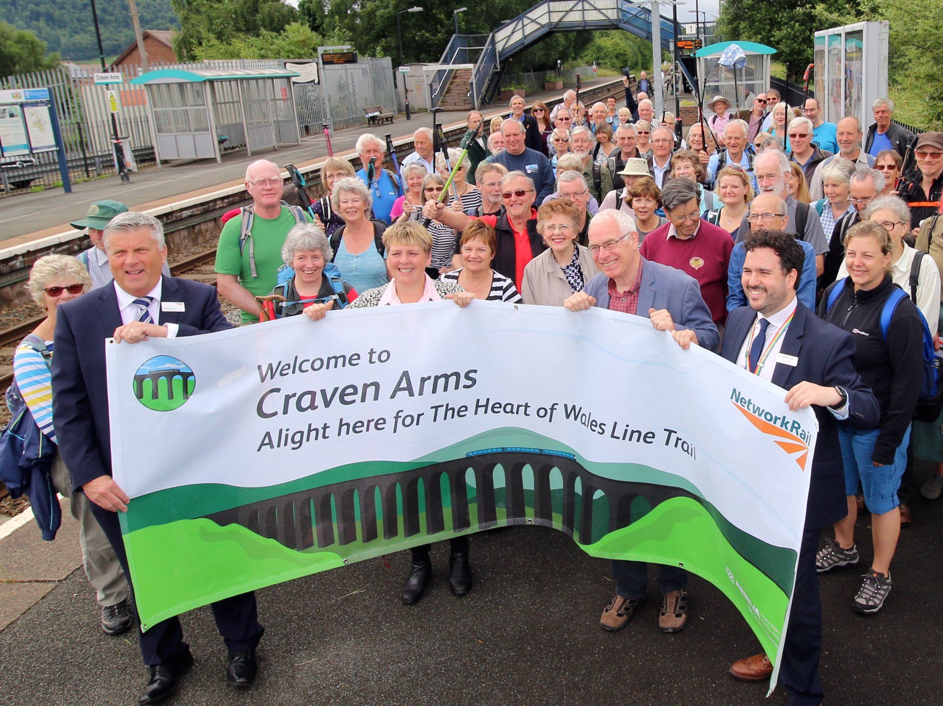
Craven Arms Railway Station to Broome Railway Station (8.5km)

1. Leave Craven Arms Railway Station from Platform 2 into the car park and turn almost immediately right along a narrow urban path, signed to Town Centre, between gardens and fencing. Cut left across the supermarket car park to the main A49 road. Cross the main road carefully and turn right to reach Corvedale Road (B4368) running left from a mini roundabout. Go down this until you reach Market Street on the right, take this and walk straight ahead, past the Land of Lost Content Nostalgia Museum until you reach the Stokesay Inn. Turn right to the entrance of the Shropshire Hills Discovery Centre, an alternative starting point.

2. If starting at the Shropshire Hills Discovery Centre, leave via the main entrance, through the car park, step over the road and turn left. Cross the A49 at the pedestrian crossing, go left and immediately right along a path into Dodds Lane. Keep ahead to join a track which runs beneath the Marches railway line to a stile by a gate. Enter the field and head slightly right following the line of several old trees. Cross a stile and head slightly right towards the hedge alongside the Heart of Wales railway. Go ahead, making your way over three stiles as you walk through fields to Park Lane.

3. Go right here, under the railway to the B4368. Cross with care over to a tarmac road and then ahead to join Watling Street. Go left on a path at a finger post showing the Shropshire Way, passing several new houses to a second kissing gate. Then onward over two more stiles in field boundaries. Look for a gateway and stile on the left mid-way up the next field. Go through this and head slightly right, aiming for a waymark post and small footbridge, then to a stile which leads into a lane. Beware of traffic!

4. Climb a double stile directly opposite into parkland. Head slightly left by the waymark post and you’ll see the buildings of Sibdon Carwood to the right. Go through a kissing gate, over the drive, and through two more gates, a footbridge and wooden stile to enter the pasture. Now aim very slightly Right: mid-way there’s a waymark post under the second large oak tree. From here aim to the left of a stone cottage ahead where you cross a stile a few metres beyond.

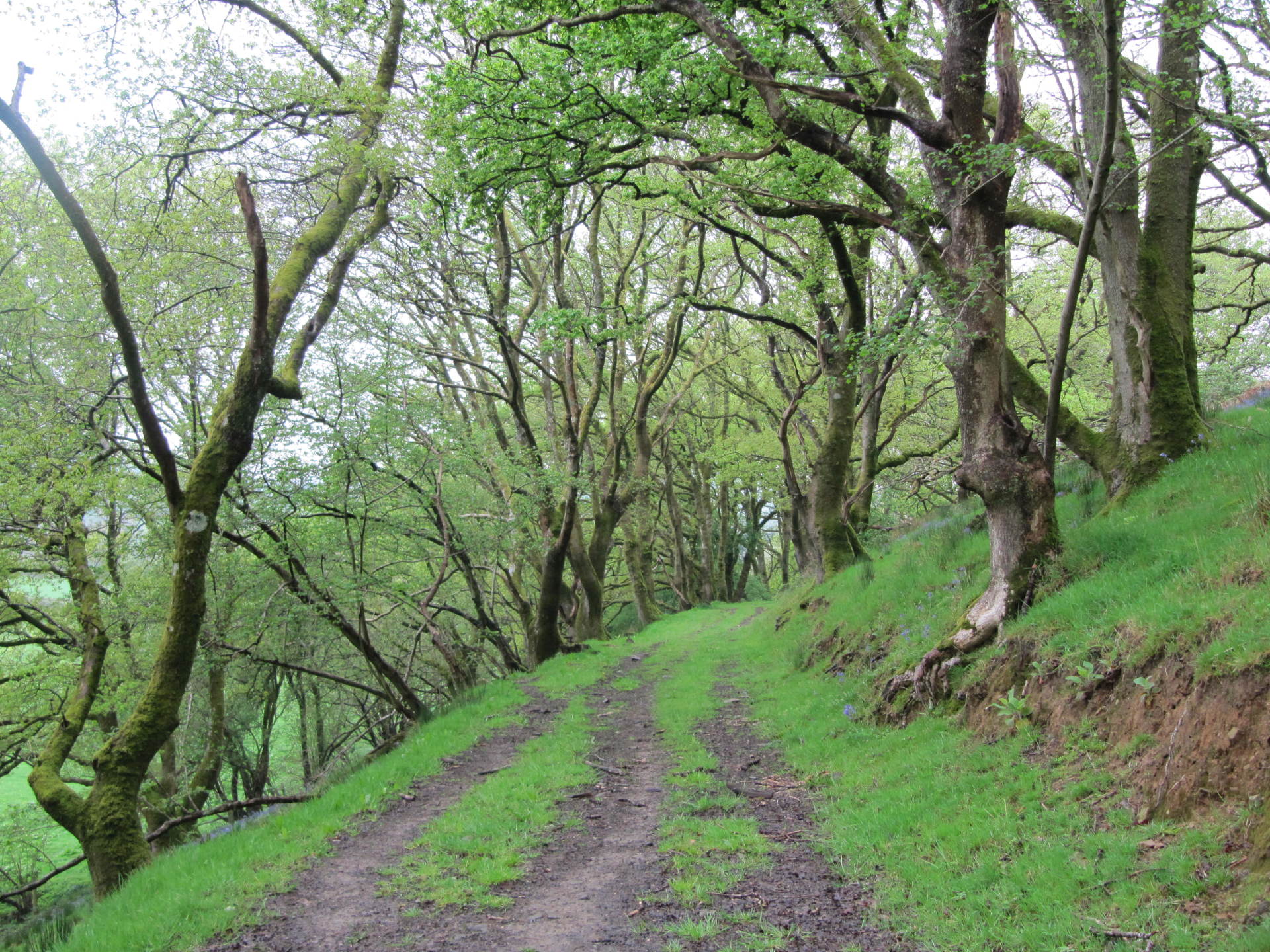
5. Rise up on an ancient track into a pasture on the left of the hedge and follow the hedge line for about 100 metres, before easing slightly left up the field to a stile by a gate with tall Scots pines beyond. Head left up a track and follow the woodland boundary all the way round to the top left corner of the field, where you pass to the left of a ruined building: there can be wet ground hereabouts. Rise up to step over a stile and continue along the fence to a junction of footpaths marked by a fingerpost.

6. Cross the stile onto Hopesay Common, owned by the National Trust, where you see Burrow Iron Age Hill Fort on the skyline ahead. Take the path ahead for about 100 metres and then slightly left to reach the high point of the hill where there is a nearly 360-degree view - the Long Mynd and Stiperstones to the north, Herefordshire to the south and Ludlow to the south east. Keep ahead to the left of a clump of tall trees and down the hill aiming to the right of a large house in the valley. You’ll see the village and church of Hopesay below on the right. In the bottom corner of the Common slip through the small gate and turn left to drop down to a kissing gate and a drive, passing a dwelling on right. Cross over the lane and go through a second small gate and over a footbridge. The path leads slightly right through the woodland to exit over a stile into a pasture.

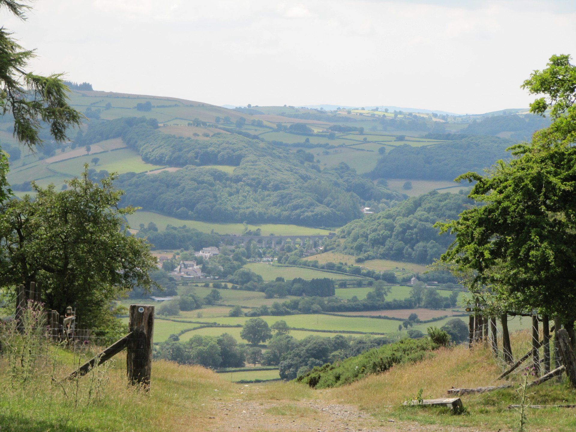
7. Continue slightly to the right towards a waymark post; the path bends slightly left to another stile. Proceed through another small wood keeping ahead alongside a fence to your left into a pasture. The path passes by gorse and scrub as you continue ahead to soon follow a grass track beneath a bank of gorse. There are several waymark posts here to guide you. The track runs beneath cottages and down to a field gate. Once through, go ahead on a lane which bends right to drop down to Aston on Clun and the Arbor Tree, for which the village is rightly famous. At the junction, cross over the B4368 road with care and turn left to walk along the pavement to Redwood Drive. Ahead of you is the Kangaroo pub and just a few metres further on and down the lane to the right (B4369 to Broome) is the Community Shop and Café.

8. At this point you can link to Broome station by continuing along the B4369, past the Community Shop to the station, which is a further 0.5km down this lane. The entrance to the railway station is on the right before the bridge.
DOWNLOAD ROUTE

Broome Railway Station to Hopton Heath Railway Station (8km)

1.  If you have been walking from Craven Arms, you can link to Broome station from Aston on Clun by continuing along the B4369 past the community shop and the Kangaroo Inn to the station, which is a further 0.5km down this lane. The entrance to the railway station is on the right before the bridge.

2. Walk down Redwood Drive, ignoring the junction on the right, to reach a track, slightly right, just beyond the houses. The path cuts right before a gate. Follow the path as it bends left and through two gates and temporary sheep pens to enter a field. You’ll see a stile ahead and one over in a fence on the right. Take the stile on the right into the large field, then keep ahead parallel to a line of trees to a kissing gate in the hedge ahead which leads onto a lane. Turn left along it, cross the bridge over the River Clun in the hamlet of Beambridge and go right. Follow this lane for about half a mile. The road bends slightly left under a canopy of trees and at this point you cut right down to a footbridge over the River Clun which is visible from the road above.

3. Walk slightly left over a stile by a field gate. Follow a line of trees just to your right and over another stile by a gate. Continue ahead to pass near a dwelling on the right; aim just to the right of a barn where you cross a stile by a field gate. Walk alongside a line of hazels to pass through another gate. Now head very slightly right towards an old oak tree and onward to a field gate. Once through, follow the hedge to your right and at the end of the field go through another field gate onto a road.

4. Turn left, over the bridge, to walk along a road which winds through the pretty village of Clunbury nestled around the church. The road rises up to a junction; bear right here to go along a lane signposted to Twitchen. In about half a mile you reach a junction with the B4385. Cross with care, then turn left to a walk 50 metres to a kissing gate.

5. Dip down to walk over a dirt bridge into the next field. Aim for the barn ahead and at the waymark post cut left and then right to skirt the barn (often muddy here) then aim leftwards to cross over a ditch and reach a small gate in the hedge. Climb this and head very slightly right to the top of the field where you cross a double stile. Rise up alongside the wood on the right then head across the pasture to a stile leading into woodland. Within a few metres to the right, the path heads leftwards and climbs gradually up a bank to a waymark post at a forestry track. Go left and proceed for about 250 metres, looking out just before the descent, for a path on the right. Follow this through the wood up to a kissing gate at a country lane.

6. Go over the lane, cross a stile and follow the right hand edge of the field where there are good views across ahead towards Wales. Cross a stile into the next field and you will see Hopton Castle. Head slightly right; you are aiming for a point just to the left of a derelict building. Go over the stile and a track dips down to a drive and then a lane. Keep ahead to a junction at Hopton Castle. If continuing to Bucknell turn right.

7. At this point it is possible to follow a link path for a 1.5 km walk to Hopton Heath Station passing by Hopton Castle. Go left along the road and turn first right signposted to Bedstone. The castle is on the right (free entry). Pass a dwelling and look for a stile on the left. Cross this and head over the field to a field gate and bridge over a stream. Walk slightly right, go through another field gate onto a lane, and turn right to walk along the lane into Hopton Heath. At the junction keep right across the railway bridge then walk down steps to the platform.
DOWNLOAD ROUTE

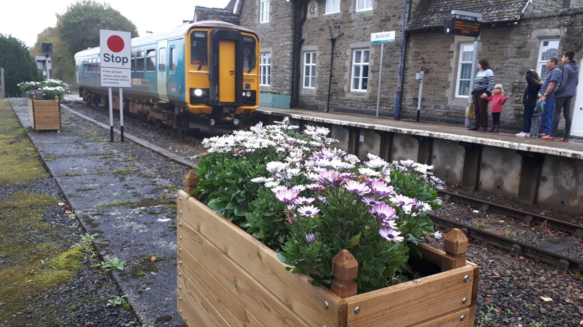
Hopton Heath to Bucknell (9 km)

1. There’s a link path from Hopton Heath Railway Station to Hopton Castle. Step up to the road, turn left over the railway bridge and left again along a lovely lane with a wide green margin. After you pass the distinctive hump of Warfield Bank on the left and the lane dips down to bend right, go left through a gate into a field. Walk slightly right across the field, over a footbridge and through a second field gate. The path crosses this second field to a stile in a hedge and into a lane. Go right to Hopton Castle further along on the left. From the Castle go left to the junction and left again through the village to join the main trail.

2. Walk through the village with the small stream to your left; the church is across a field to the right as the road bends left to pass the entrance of Upper House Farm. As it rises and begins to ease right, go through a gate on the left into a field and follow the tractor track ahead, through two pastures and gates. The track rises, bends right and then left to reach a field gate into Hopton Wood.

3. Go left up to a junction and turn sharp right onto a woodland track, sometimes shared with bicycles. Follow this track round gentle bends until it starts to descend where at a waymark post you cut left upwards on a track which climbs up steadily for some distance, passing one waymark post at a junction before reaching the top.

4. Cross straight over the forestry track and continue ahead on a grassy footpath to leave Hopton Wood. Where the track veers left following the conifers, go straight ahead, passing on your left a conifer seed orchard, the path being a little overgrown in the summer. Eventually you reach a small gate before Meeroak Farm, and head to the left of a barn. Follow the track through gates and down to a drive. Continue ahead until you go through a gateway. Turn right here along the edge of a wood and then as the path veers left cross a stile on the right into a field.

5. Go slightly right across the field to the opposite boundary. Turn right here to walk down the field edge to cross a stile by a gate: there are wonderful views up the Redlake Valley. Continue down over another stile by a gate, past Honeyhole Farm. Follow the hedge to the left down towards a kissing gate above a house and stables. Drop down to the painted kissing gate. Keep to the left hand boundary through the garden to a metal field gate on the left. Follow the waymark through the gate into the field, turn right and follow the hedge down to a field gate leading onto a road.

6. Turn left along the road. Where it bends sharply right go through the field gate on your left. Head slightly right and along the track uphill, through a gate and past a line of redwoods on your right. On reaching another field gate ease off right along a bridleway; it contours round the base of Bucknell Hill, through woodland above the River Redlake. After you leave the woodland pass through a small gate and field gate on to Bridgend Lane, leading into Bucknell.

7. Follow the lane through to the main road in Bucknell. Turn left for the railway station, past the Baron Inn. The road bends right and across a bridge. Turn left after the bridge, along a surfaced path to the left of the parish church. This gives out at another main road. Turn right to pass the Sitwell Arms and over the level crossing to enter the station. If continuing on the trail turn right at the end of Bridgend Lane.
DOWNLOAD ROUTE

Bucknell Railway Station to Knighton (14km)

1. From Bucknell station, go left over the level crossing and right along the pavement to pass the Sitwell Arms. Just beyond, turn left to walk along a surfaced path by the Redlake River. Keep to the right of the church and turn right to walk over the bridge; the road bends left and passes the Baron Inn. At the junction of Bridgend Lane you join the main route. Continue west on the lane in Bucknell and over a small bridge. At the right hand bend keep straight ahead onto Daffodil Lane past recreational grounds. It begins to rise; keep straight ahead.

2. The track rises, to then level for a section before reaching a junction in Bucknell Wood. Go right here to join a forestry track and stay on this as it rises up and bends to the right. At the second fork take the left hand track upwards; the track curves further leftwards and rises again through a group of native trees, principally oaks. Eventually you reach a staggered junction; go left and then follow the track as it curves right, climbing to pass beneath a line of fine trees. The track bends left and continues along to the top of the wood where a gate leads out onto open pasture.

3. The route continues westwards for some miles now along an old droving road until it reaches Offa’s Dyke Path. Follow the tractor track ahead from which there are fine views leftwards to Caer Caradoc hill fort sitting above the hamlet of Chapel Lawn, which is seen below in the Upper Redlake valley. There are also views back to the other Caer Caradoc near Church Stretton. At the junction of tracks, keep ahead through a gate and walk up to the wood. Go through another field gate and pass by a stile on the right.

4. Continue ahead to go through two gates by a belt of woodland. Follow the track ahead through a number of pastures, passing through four field gates. The track becomes enclosed by hedges and is wet in places as it descends through another gate and past buildings to reach the main road at Five Turnings; this literally describes a junction of five ways in earlier times.

5. Cross the main road with care and go through a narrow gate just behind the GR- marked post box to continue on the drovers’ route between hedges and then through a gate and slightly left, rising up a large field towards pine trees on the ridge ahead. Follow the fence on the left hand side to a small gate and ahead along a track which joins Offa’s Dyke Path national trail.

6. Turn left to follow the national trail (which is way marked with acorn symbols) through to Knighton. There is a good section of the ancient monument just to your left. Make your way along the path, passing through several gates, always with a fence to the left. There are also magnificent views up the Teme Valley and across to Knucklas Castle, village and railway viaduct. On reaching a seat at a local viewpoint the path curves left and becomes narrower as it drops down the hillside to a finger post. Go right here to drop steeply down to a lane: neat footwork is required as the path is heavily eroded in places. Those needing to walk directly towards Knighton railway station should turn left here along the lane: it it takes about ten minutes to walk to the station

7. Cross the lane, go through a gate and follow the worn path to cross the railway track with extreme care and then the footbridge which crosses the RiverTeme. Follow the river bank as it curves to the left, through kissing gates into woodland, in which you cross the England-Wales border. The path then rises as it turns right, heading up to the Offa’s Dyke Centre and Knighton itself.
DOWNLOAD ROUTE

Cynghordy Railway Station to Llandovery Railway Station (11km)

1. Leave the station entrance and walk ahead down a lane lined with willow and thorn to a junction at Cwmcuttan. Go right at the first junction and right again at the second to pass through a tunnel beneath the railway. Follow the lane up the hillside, with a lovely array of roadside flowers which begin in the Spring with celandine, wood anemone and wood spurge, giving way in summer to wild strawberry, campion and common dog violet. Follow the lane until it bends sharp right. You go left here, through a field gate on a track to a second gate and footbridge over Nant Bargoed.

2. The track rises up to pass an old farm, and soon becomes a surfaced lane passing a dwelling before reaching a junction. Keep ahead up to a summit where there are excellent views across to the Carmarthen Fans and follow the winding lane down to a point where there’s a drive on the left to Cefnllan. On the right is a small gate and footbridge. This is your way into a large field where you head very slightly left to skirt a protruding field corner and through wet ground to cross a footbridge over a stream.

3. Cross a stile into the next field and head very slightly left again to go through a field gate. Proceed in a similar direction across another wet rush pasture to cross a stile just beyond a small stream, about 20 metres to the right of a corner. Once over go straight ahead to the bottom of the slope (clear of the very wet ground) and then go left parallel to the stream. Cross a stile just to the right of the stream, often surrounded by mud, and continue ahead with a hedge to the right although once again there are overhanging branches. The old track curves right up to Rhandirberthog Farm.

4. Go left on a track, before the farmhouse,  which soon cuts right through Pantglas farm and continues to climb, with sumptuous views across to the Brecon Beacons, until you reach a junction. Turn left here and walk down the lane for just over a kilometre to reach Maes-y-gwandde farm on the right.  Go right after the buildings and farmhouse down a concrete road, passing through two field gates; it then becomes a track which soon bends left to descend into the valley. The track then curves right, passes through a field gate and climbs up to a hairpin bend cutting left to rise to Cefnrickett farm.  Go through another field gate as the track bends right towards the farmyard and house.

5. Do not go up to the house. You cut left over a stile by a field gate and then turn right to walk along a green track with a hedge on your right. Go through a gateway and head very slightly left down the hillside. There are excellent views across to the Brecon Beacons from here.  Cross a stile by a field gate in the next field boundary and continue ahead to the next hedge with woodland to your right. Climb a stile and keep ahead again to enter the wood along an old track which curves slightly right to a field gate. Go through and then look for a stile on the left. Cross this and drop down the field to go through two small gates, one either side of a track.  

6. On reaching the road, cross with care and turn left to the junction then right towards the historic Dolauhirion Bridge, designed by the Reverend William Edwards of Pontypridd and built by his son Thomas in 1773. The Field Magazine in 1961 proclaimed it to be the prettiest bridge in Britain. Beforehand, cut left over a stile. Pass through two kissing gates then along a corralled section between gorse bushes and then follow the field’s edge as it curves around left to another kissing gate. Once through turn left to walk alongside a stream. Proceed through another kissing gate, over a road, and right over a wooden footbridge and gate into a field.

7. Follow the hedge on the right around buildings at Tonn to cross a road guarded by two kissing gates. Follow the hedge to the right and pass through another kissing gate into the next pasture. Now head slightly right to go through a kissing gate before a shed with a corrugated iron roof. Go left along a green track, over a stile by a gate and head very slightly left alongside a hedge and through a kissing gate. Continue along a green track to exit through another kissing gate onto a main road to the left of a road bridge. This was once a fording point known by drovers to be extremely dangerous in times of flood.  Turn left for the short roadside stretch to Llandovery railway station.  
DOWNLOAD ROUTE

Llandovery Railway Station to Llangadog Railway Station (19 km)

1. Leave the station entrance and turn right to walk along the main road into Llandovery town centre. Look for the turning on the right by Llandovery tourist information centre and into a car park/bus stop to a point beneath the grassy mounds of Llandovery Castle. Just before the castle ruins go left on a track beneath a statue, through gateway to join a path along the riverside. Climb up steps and turn right to walk over the Waterloo Bridge.

2. The road bends left and in about 100 metres turn right on a concrete road through a field gate and yard of Bronallt farm. Go through a small gate by a field gate and climb away from the farm, rising up to a kissing gate by a second field gate leading into a wood. Follow the path to a wider track where you bear left and then right as the track curves right and continues to climb. At the fork, turn left and exit into a pasture by way of a kissing gate. Do not be tempted to follow the hedge line beyond the first corner; head slightly left up the hillside across a fairly large field. There are great views across the Tywi valley as you rise up towards the far corner (not the field gate seen on the horizon). Go through a kissing gate and continue to walk in the same direction across the field, well to the right of the dwelling, Cefn -yr-allt-uchaf, which is situated on the left. Proceed through a kissing gate by a field gate, passing by pools and continue very slightly left to a kissing gate in a fence. Continue up a drive through a kissing gate by a field gate.

3. In about 25 metres, the track bends left, but you go right to descend into the valley, heading very slightly left towards tall gorse bushes and a tree line. Go over a kissing gate by a field gate and walk ahead along a tree lined track. You soon reach a junction where you go left to rise up another tree lined track, over a stile by a gate and climb up the wooded hillside known as Allt Llwynywormwood referring to wormwood, an important herb used in medicine, but perhaps better known for its aromatic properties in the making of the rather more lethal absinthe. Cross a stile by a field gate and continue upwards to go through another gate and after 30metres or so you reach a crossing of tracks.

4. Go right through a field gate and wander along a track where young trees have been planted on either side. Pass by a dwelling on the right as the track bends left and then right and descend through mixed woodland with views across to Llwynywermod Park, now in the ownership of the Royal Duchy. Ignore a track off to the left over a bridge spanning the Nant Mydan, and your way is along the track continues ahead then bends right to a field gate.  

5. Keep ahead along the side of the valley and you will see a farm, Pantygaseg, above to the right. The track curves right, and at this point, look out for a stile on the left. Cross it and drop down slightly left to cross a footbridge over Nant Mydan. Climb up the hillside towards the right of a bungalow seen above. Go through a small gate onto a track, turn right and follow this for about 20 metres before the track curves right.

6. You, however, nee d to keep ahead to climb up the valley side on a narrow path between tall trees of varying hues which clearly like the rich habitat of this small ravine. Go through a small gate into a pasture and keep ahead near to the hedge on your left. Go through another small gate and now aim very slightly right. Head to the left hand side of the roof seen ahead at Myrtle Hill, and go through two kissing gates by a cottage onto a drive and ahead at the road (do not turn sharp left).

7. The lane ahead winds down between two woods, one being Coed Leter, managed by the Woodland Trust, and you are able to walk around it if you wish. You soon arrive in the village of Myddfai where you turn right by the church to pass Myddfai Community Hall and Visitor Centre.  There’s a café and shop and the profits from this venture go to Myddfai Ty Talcen, a charity which helps to sustain this isolated rural community. Continue along a narrow lane to pass by the entrance to the old vicarage and at the next corner, go ahead through gates towards Llwynmeredydd Farm, the home in previous centuries of one of the physicians of Myddfai.

8. Before reaching the house turn right through double wooden gates and rise up a track through a scattering of trees, up to and through a field gate. Go immediately left through another field gate. Brace yourself and climb up the bank, slightly right and then left, keeping to the right of a spinney of trees and  heading for the top left corner of the field. Part way up, you will see an outcrop; that is where you are heading. Go through a gate and proceed ahead with a hedge to your left. There are marvellous views from this vantage point across to the Carmarthenshire Fans, especially Mynydd Myddfai and Mynydd Bach Trecastell. Go through a gate and ahead to join a cross roads of paths where there is a cattle grid.  
9. Cross the track and follow the hedge on the right up the bank for about 100 metres. At this point head half left across the pasture with wonderful views across Carmarthenshire. Descend to the bottom left corner to cross a stile then keep ahead with a hedge to your left trying to avoid a a wet flush. Go through a field gate ahead and descend again with the hedge left through a second gate and then ahead to pass through third field gate to join a track by a wood. Go right through two gates by a barn above Goleugoed farm.

10. At the junction keep left and as the track sweeps right, keep ahead across the pasture, aiming for the bottom left corner. Go through a field gate leading on to the road. Turn right and at the junction go left. Pass by Cilgwyn Lodge with delightful gardens and as you rise up the hillside go left at the finger post through a gate, marked Pistyll Gwyn, and proceed up a drive.

11. As the track bends towards the dwellings go right over a small footbridge and stile into a field with Llety-ifan-ddu on your left, a handsome late Georgian country house. Keep ahead to climb alongside the boundary wall and fencing to reach a stile by an old barred gate. Go over it and keep slightly right of the old quarry working up a track into a field. 

12. Climb steeply up the hillside aiming very slightly right to a kissing gate by a field gate. Keep in a similar direction in the next pasture to another kissing gate and follow the fence on the right through to a third kissing gate; keep ahead again. If you happen to have an older map, please note that there has been a diversion here in recent years so as to avoid Glasallt Fawr. Go through the second field gate on the right (approximately 50 metres after passing an old wooden chalet in the adjoining field to the right). Once through the gate, turn left to follow the fence around to the right, before descending slightly into a dip and rising to a kissing gate in the far left hand corner of the field.

13. Pass through this kissing gate and drop down the hillside alongside a fence on the right.  Halfway down, as the fence cuts right, keep right through an old tree line, and bear diagonally downhill towards a kissing gate in the bottom right hand corner of the pasture.  Pass through the kissing gates and the path as it zig zags down to the access track to Glasallt Fawr, which is on your left.

14. Go straight across this access track and through a kissing gate, heading down to another small gate and track Proceed through a kissing gate into a large field and keep ahead along the hedgerow through another kissing gate. In about 100 metres go through a gate on the left and then head slightly right across a field of wet rush to exit at a kissing gate onto the A4069 road. Cross with care, especially looking for cars approaching at speed from the right. Go left and then right up a narrow lane which climbs at first, curves to the left and then levels with fine views over the Tywi Valley. Llangadog is about 3 kilometres away.  The lane eventually descends, steeply in places to the Llangadog. At the main A4069 road turn right for the railway station, less than half a kilometre away. Otherwise turn left for the village and the route through to Llandeilo.
DOWNLOAD ROUTE

Llangadog Railway Station to Llandeilo Railway Station (16 km)

1. Llangadog railway station is about half a kilometre from the centre of the village along the A4069 so take care. Leave the station entrance, cross the main road with care and turn right to walk over the railway crossing and along the pavement as far as the turning before Pont Brận where the pavement gives out. Pass by the church on your left and then up towards the square.

2. Be vigilant here for it is easy to miss your turning! Look for a right turn (No signage in village) along a narrow thoroughfare just after Llangadog Post Office. This leads to a junction with Walters Road. Go right for about 100 metres along it before turning left between houses on a path ahead now between gardens. Pass through a kissing gate into a pasture. Continue ahead through pastures and two more kissing gates onto Carreg Sawdde Common which is a nature reserve. Go ahead for a few steps over a footbridge where you come to a junction of paths; keep left here to proceed through scrub. Continue ahead and you’ll see a barn on the left in an adjacent field.  Aim slightly right to Pont Sawdde on the open access land which was at one time a larger unenclosed grazing common, held by the Bishops of St Davids in the late 13th century.

3. Go over the bridge and keep ahead on the Bethlehem Road into the village of Felindre. Take the second right turn and walk up to another junction. Keep left here along a track between dwellings and through a field gate into a pasture. Follow the left hand hedge, through another field gate, then go through the kissing gate on the left and turn right to walk alongside a hedge now to your right passing through three more kissing gates in fields prior to Bryngwyn Farm. As you near the barn, go ahead through two field gates immediately to the right of it. Proceed along the farm drive, through a kissing gate to a lane and continue ahead again, past another farm on the left and then eventually to arrive at a group of houses and farm on the right.

4. The lane bends right but you need to continue ahead at this point.  However, do not stay on the track.  Make your way through the field gate on the left leading into a hillside pasture. Now follow a bridleway along the fence line on your right at first, then rising up alongside a wood to pass through a gateway and a squelchy area. Keep climbing up the hillside to reach a stile by a field gate. Go over it and up again through two small gates before reaching a road. Turn right to make your way along it to Bethlehem where this is an interpretation board and seat to rest awhile.

5. Keep ahead at the junction, dropping down to a second junction opposite a bungalow. Go left through a kissing gate next to a field gate and proceed along a track to come to sheds ahead and dwellings on the left. Continue to the wall at the back of the houses, go left along it for 20 metres and right through a small gate into a meadow. Head slightly right to pass through a field gate and then follow the hedge to the right up to a kissing gate by Bethlehem chapel.

6. This gives out at a kissing gate on to a lane; go right and gather your strength for a climb up to the car park for Carn Goch situated just off the road. The trail makes its way through the monument, but is not guided by waymark posts, although there is a clear green swathe of grass to follow. It peels off left from the car park and bends right to climb up to pass through the indistinct remains of a small ancient Iron Age camp. On a good day there are splendid panoramic views along this section. The path then dips down and climbs up again just to the right of the stones; follow the path along them and then cut left to rise up to the inner camp of the main hill fort which are very clear to see. Continue ahead and then very slightly right to the end of the camp where the path eases down gently enough across a heath strewn with stones. It curves slightly right to run down to a lane; the electricity poles present themselves as guide posts.

7. Go right along the lane. Proceed through a field gate at Garn-Wen and walk up the drive for 50 metres where you cut off slightly left, through a small gate and along a bridleway. The track climbs up to and through another field gate, bends left and right and then you cross a stile to walk ahead again. You rise up to a junction of paths at Bwlch y Gors. Pass through a gate and turn right to follow a path up to a gate and turn right to walk over a boardwalk to a stile, and then slightly right through a gateway. The path then cuts left to follow a fence towards Cerreglwyd Woods.  There are lovely views all along this stretch across the Tywi valley.

8. Go through a gap in a wall, turn right and cross a stile in approximately 60 metres. Now cross a stile and follow a sunken path bordered by gorse and whinberries to a finger post. The path now drops quite steeply to a tractor track. Turn left to climb again through coniferous trees. Continue straight across at the crossroads and then climb a stile onto moorland where you continue ahead with a craggy outcrop of Carn Powell, to the left and some streamlets to be crossed before you tackle the ladder stile in the next boundary wall, the first on the trail! Continue ahead along fence and then strike out across the field to a field gate which leads to a lonely road junction.  In good weather, you’ll catch your first glimpse of the impressive ruins of Castell Carreg Cennen.

9. Your way is ahead on a road signposted to Trap, continuing along it towards Blaencib and Helgwm woods in about 1 kilometre. It is a quiet lane offering splendid views across to Carreg Cennen castle and you’ll pass the turning on the right to Blaen Cib Farm.  Soon after the Beacons Way cuts off left across heathland on route to Castell Carreg Cennen. However, your way to Llandeilo is via Hafod Farm.  Look for the next turning on the right indicated by a fingerpost to Hafod.

10. Follow the farm track down, passing through a field gate and turning right towards a farmhouse on the right and barns to the left. Follow the drive down left to towards two gates, but beforehand cut left through another field gate and along a track running below the barns; this soon turns right. However, you continue ahead through a field gate and then follow the hedge to the right along to a stile by a gate.

11. Once over go slightly left through a field of very lush rush to walk near to the fence to your left. Walk beneath the trees and then proceed ahead for a few paces before cutting slightly right across a second field festooned with common rush. You are aiming for a stile beneath trees part way down; it is not easily seen at first. Cross this stile by a broken gate and proceed ahead in the next field to a small stream beneath a group of trees. Once through head slightly right across the field to a corner near to barns at Llwyn bedw farm. Cross a stile just to the right of a field gate onto a lane.

12. Go right to drop down the lane to a bridge over the Afon Cib and then rise up to pass a group of cottages. The lane bends left by a saw mill at Cib and then pass a turning on the left to Cwm canol. Look for the entrance to Tregib Wood on the right.  The path through Coed Tregib is permissive and we are thankful to the Woodland Trust for allowing access in this splendid piece of woodland.

13. Pass a gap by a gate and descend through the wood. The main path descends to a junction at a waymark post. Go ahead here; the path winds its way between trees curving slightly left and then right down to cross a stream.  This is where it gets difficult at present but be assured that there are improvements in the pipeline. Cross the stream and head slightly right through very wet ground until you reach a boardwalk. Follow this to exit by a wooden sculpture of an otter. Go ahead, through a gate into younger woodland protected by deer fences. Go ahead and then along a compacted path to reach a car park. Cut right here before the road on a path leading to a small gate onto Bethlehem Lane.

14. Go right and continue over Pont Breinant walking along the road; be wary of traffic along this lane. Look for a footpath signpost, on the left after the entrance to Castell Ddu. The surfaced path leads off left down to a gate and then across the pasture. This is your way to a wonderful suspension bridge, known locally as the Swingbridge, over the River Tywi. The path continues ahead and then left along a corralled section before joining a track running beneath the railway line and then up to Church Street.  Turn left here to continue on the trail to Ffairfach, otherwise right and immediately left for the town centre. If you are heading for Llandeilo station then go right along Crescent Road and right into Latimer Road and right again down Alan Road to Llandeilo Railway Station.
DOWNLOAD ROUTE

Ammanford to Pontarddulais (14 km)

1. Leave Ammanford railway station, turn right into Station Road and left at the main junction. Turn right into College Street (A483) to walk through town, passing the bus station on the left,  to the junction corralled by railings. Cross the road to proceed ahead along Quay Street, a pedestrianised area which leads to a sculpture depicting the mining heritage of the town. Go ahead again at the first roundabout, passing by the Railway Hotel, and through gates over the Amman Valley railway line. Continue to another roundabout and aim towards the bridge in Park Street over the River Amman.  However, go right immediately before the bridge on a surfaced path alongside the river. Follow this down to the rear of the Tesco supermarket where you cut right across a road (currently a dead end) to join the walk and cycling route to Pantyffynnon which also happens to be the Fair Trade Way at this point. This runs along the back of the supermarket, then left alongside security fencing and the railway track.

2. You reach a junction.  For those finishing a walk at Pantyffynnon railway station go over the tracks again and turn left for the station, about 5 minutes at most. Otherwise, go left at the junction to continue. If you are starting your walk at Pantyffynon railway station leave the platform next to the level crossing and go right along Pantyffynon Road. Look for a road off to the right across the railway line and keep ahead to join the main route.

3. The path runs alongside Pantyfynnon rugby club ground to cross a suspension bridge over the River Amman and a small footbridge over a tributary stream. Follow the tarmac lane up to the village of Garnswllt where you come to a turning circle and houses. Go left to walk up the road, Lon y Felin, through a housing estate to a junction with Heol y Garn. Go right here and pass by a row of houses to your right. As the road bends right, go left along a track past two more houses, through a metal gate to a wooded slope where there were once quarry workings.

4. Now look for a path up steps through the wood (also waymarked as Penlle’r Castell Walk). Climb more steps through the old workings and even more to reach a stile into a field. Continue left along the old boundary wall, now covered in grass and moss, up the slopes of Garnswllt to join a tree lined wall. Go right along the wall for about 10-15 metres and then cut left over a stile. Continue uphill, keeping a ruined wall and hawthorns on your right, until after about 100 metres you encounter another wall coming in from the left. The two walls then channel you firstly to the right, then to the left, where there is a waymark post indicating a direction uphill. Continue to climb, heading diagonally up the hillside to a narrow gate nestled by a field gate. Once through, keep ahead with a fence to the right to a go through a kissing gate.

5. Cross the farm track and through another kissing gate to climb again with a fence now on the left rising up to a few steps and a small gate.  Once through, keep ahead again across a pasture, through another gate by a field gate, and onward to reach a stile in a wooden fence. Cross a stile and keep slightly right to pass through a wooden field gate to reach the bucolic ruins of Bryncyffon farm. Walk by the ruins and through a small gate in a field gate. Proceed through another small gate and continue alongside woodland and fencing to rise up the valley along a green track in the same south-easterly direction. Continue to rise as it edges up the valley towards a line of pylons on the skyline; you are aiming to the right of the right hand pylon. You’ll pass through wet ground as the track becomes rougher, curving slightly left until you meet a track coming up from the left, St Illtyd’s Walk, which you join for the walk through to Pontarddulais.

6. Go right on this farm track which curves slightly left up to join a wider track. Go right here to walk alongside it to a public highway where you turn right again and rise gently uphill. When this road begins to descend look for two tracks leading off left (this is now different to the St Illtyd’s Walk shown on older OS maps). ).

7. Keep ahead on the left hand green track which bends left and right then peters out as you proceed across the moor.   Keep ahead, aiming for a waymark post to assist navigation, across the expanse of heathland known as Graig Fawr (the compass bearing in poor visibility is 240 degrees). Continue ahead, now rising slowly towards another waymark post on the horizon. There are tracks along this section which are wet in winter but often dry as a bone in summer: they are often used by horse riders and farm vehicles. The trail dips slightly at first then rises again, bending slightly right and then left to pass to the right of a triangulation point. On reaching the higher ground, you’ll soon capture wonderful views of the Loughor Estuary, the Gower Peninsula, Swansea, Port Talbot to the south east and to the west the Preseli Mountains.

8. From the triangulation point, continue ahead along the plateau to pick up a track, (the compass bearing for poor visibility is 220 degrees). This track, faint at first, becomes increasingly better defined. You will soon be able to see the tapestry of fields and pockets of woodland to the right in the Loughor Valley. Follow the waymark posts as the track descends gently at first then more steeply as it cuts right and then left down a slope; there are outcrops to the left. Follow the main track as it ventures across the bracken clad moor with other tracks joining from time to time. You eventually drop down to a metal gate and a bungalow beyond, to leave the moorland at Pentrebach.  

9. Follow the lane ahead as it passes by a number of dwellings down to a junction. Turn right here to walk along a steep sided lane of some antiquity bordered by a line of beautiful old oak trees.  It passes through an urban area, along Dantwyn Road, to a junction by a green. Go left along Glynhir Road and then this continues into Caecerrig Road, past a school, and onto Dulais Road, where there is a bus stop for Swansea on the left. Follow Dulais Road to a junction with St Teilo’s Street. Turn right here to pass through the centre of town to a junction. Go right for the main bus stops (and public toilets), or keep ahead for Pontarddulais railway station, which is signposted off to the right before the bridge over the River Loughor. The traffic light junction marks the site of where the closed section of the Central.
DOWNLOAD ROUTE

Pontarddulais to Llanelli (19.5 km)

WARNING : Please note that the Loughor estuary is tidal and that on a limited number of days when there is a high tide it may not possible to complete this section. Walkers are advised to check tide tables available here.  We plan to issue an alternative to this route for use when tides are running high.

1. From Pontarddulais railway station, turn left onto the main road (A48), ahead at the crossroads and cross over to take the right fork through town along St Teilo Street. At the Farmers Arms turn next right into Trinity Place and then within 50 metres left at the fork to Coed Bach. This leads into Coed Bach Park.


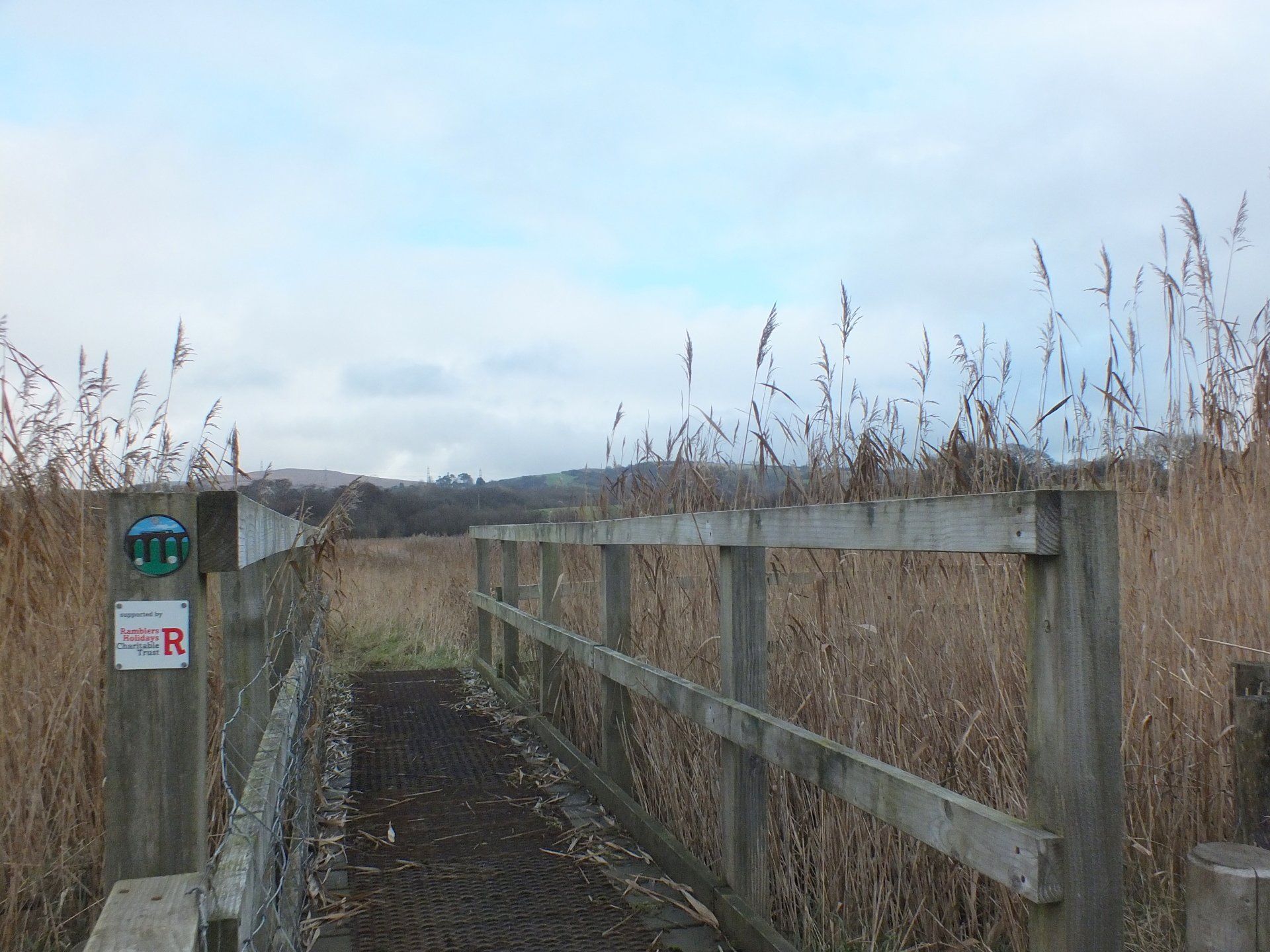
2. Continue ahead on the main path and follow this as it bends right, down past the football pitch,  left along the bottom edge and left again to come to a point where there is a junction marked with a finger post. Go right here through a small pocket of woodland to a kissing gate, over a footbridge and an old railway line (now almost grubbed out), which is the disused section of the Central Wales line (now known as the Heart of Wales Line) which ran from Pontarddulais to Swansea Victoria. The path leads to another kissing gate. Here there is a junction of paths. Do not take the path signposted left which rises slightly across the field, nor follow a track which drops slightly right and downhill to a double field gate. Instead go straight ahead towards a hedge, in which a kissing gate is partly concealed. This kissing gate leads onto a hard-surfaced footpath towards to the River Loughor.


3. Follow this hard-surfaced path and on reaching the riverside go left through a kissing gate, across a footbridge and a second kissing gate so as to continue alongside the river bank bordered by common reed. Cross another footbridge and kissing gate and then with the fence to the right proceed through another three kissing gates (ignore the stile) aiming towards the farm buildings ahead. Here there is a junction of paths: ahead in the saltings lies the graveyard of the former church of Llandeilo Talybont (famous for its mediaeval wall-paintings), which was dismantled stone by stone and re-erected in the Welsh Folk Museum at St Fagans. This short diversion of 200 metres is well worth the effort. Otherwise, turn left through another kissing gate and pass round the outside of the farm buildings to join the farm access track. Turn left along this track towards the motorway.   


4. Pass beneath the motorway through a small gate within a field gate and then follow the track as it firstly bends left and then to the right. Walk under the railway and continue ahead to pass by the entrance to Castell Ddu farm. Cross the bridge over a stream, then turn right to cross a stile by a field gate. Follow the track as it bends left at a junction and becomes a lesser path with the estuary to the right; you can smell the sea air!


5. This is where you have to be careful, for if there is a very high tide the field is submerged and you will have to turn back.  We recommend that you follow St Illtyd’s Walk from Pontarddulais to Llanelli on the other side of the estuary if this problem occurs. It is waymarked throughout. 


6. Continue ahead, past a sewage pumping station, to cross a stile which leads to a short marshy   section, then ahead slightly left to a kissing gate in a fence, about 80 metres distant.  En route you will cross over a stream by a railway sleeper-type footbridge and a track. Once through the kissing gate, walk with the fence to your right through a wet patch to a small gate. Continue ahead in the next field. Climb a stone step stile and walk ahead again to cross a second stone step stile in the next field boundary. Once over continue to walk very slightly right to a third stone stile by an electricity pole. Finally drop down to a wooden stile and small bridge to a road by Grove Farm.


7. Go left on the road for about 10-15 metres before turning right through a small gate, then rise up to another gate by a field gate. Pass through and follow the field hedge to your right to walk up the field, soon curving right into marshy ground so care is needed to navigate a way through. Warning - this particular section is akin to a quagmire in very wet weather. Aim for the very top left corner, as the field narrows, where there is a stile beneath bushes. Cross it and the small bridge to enter the next field. Turn left to walk alongside the hedge on your left until you reach a kissing gate on the left. Go through and then aim slightly right. Climb the stile by the gate and walk along the hedge to the right. You come to a kissing gate just beyond a track, and once through, continue ahead to another stile by a field gate. Proceed with a fence to the right to cross a stile in the corner a few metres right of a field gate. Turn left and then right to walk along a track leading a stile by a gate with a house to the right. You come out onto a lane known as Llannant Road.


8. Cross over and proceed through a small gate opposite leading into a field. Head slightly left to a kissing gate in the next boundary and continue ahead in the pasture with a hedge and housing to the left. Cross a stile by a gate and continue along a tree lined track. Climb another stile by a second gate and continue ahead to cross a third stile into another pasture where horses sometimes graze. Follow the hedge line on your left down to a gate. The track bends slightly right then left to a stile by a field gate. This leads to a junction where Gwyn-faen farm is to the right. Go left at the junction for 30 metres or so.   


9. Go through a kissing gate and turn right along Gwynfe Road, initially a track which soon becomes a surfaced road bending right and then left. Continue along it to come to more dwellings, but before reaching the main car park you will see a fingerpost on the right.  Leave the road to follow the bridleway which bends to the left, as indicated by waymarker posts, but as it bends right to go out to the estuarial point in Glanymor Park, and just before you reach the car park, keep ahead to join a path along the foreshore of the Loughor, keeping right at a junction then onwards towards an engineering works in the distance. Leave the park by a gate and ahead on a road by the works and Loughor Boating Club, then along the pavement to Loughor Bridge. 


10. Go right to cross the bridge on a pavement. At the far end of the bridge turn right to descend steps and ahead towards the Schaeffler factory. At the junction, go left to walk along Yspitty Road. Those wishing to finish at Bynea railway station should continue ahead for a 10 minute walk to the station, located on the right. Otherwise, go left to cross over the B4297 to join the Wales Coast Path, through a car park and to a junction not far beyond. Turn left here.   


11. For those joining the trail at Bynea follow these instructions. From Bynea station walk up from either platform to Heol-y-Bwlch. Turn left, cross the road and continue towards Loughor. Pass a garage on the right which is opposite the chemical works.  Look for a concrete track on the right between buildings and a security fence. Go right along the track.


12. Go first right to walk over the suspension bridge. Continue on the wide track which descends to run alongside the Loughor estuary (shared with cyclists, so be watchful). Over ten miles of coastline has been developed as the Millennium Coastal Park and this is an exceptional traffic free route through to Pembrey, so you can expect to see far more people on this section of route than on the Heart of Wales Line Trail itself. There are particularly good views across the estuary to Penclawdd and the Gower Peninsula. The surface is sometimes compacted and in other places a sealed surface. There are also braids along the seawalls which offer closer views of the seafront.


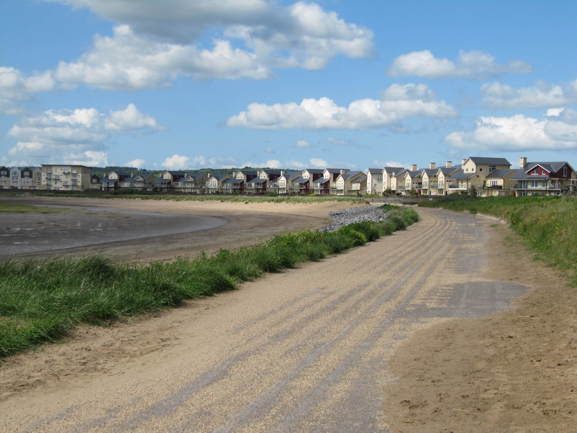
13. You eventually reach the entrance to Penclacwydd Wetlands Centre (run by the Wildfowl and Wetlands Trust) on your left. If you are not visiting then cross the road and continue ahead.  Before reaching another road go left and follow the track as it bends left then right to skirt a golf course. There is a parallel path easing off the main track which allows a superb view of the birdlife in the salt marshes. The track eventually comes to urban development at Machynys, turns right by the Millennium Beacon, and joins a road alongside housing. The area has been rebuilt with houses overlooking the sea where industry was once dominant.  The path then cuts right again, when it reaches the former entrance channel to the old Copperworks Dock. Follow this to the road and then go left taking the path alongside the road bridge and the roundabout. The track continues towards the North Dock, where the Discovery Centre is situated. Simply follow the trail as far as the next roundabout to reach it. When at the next roundabout turn left to the Discovery Centre.


14. However, if you are not going to call into the Discovery Centre, cross the road on the right before the roundabout and then continue ahead to walk into Stryd y Mor (Marine Street). Follow this until you reach Glanmor Road, which is easily identified by two historic chapels located nearby. Bethel Baptist and Siloah Independent chapels both date from 1840, but the former was enlarged in 1850. Llanelli, like many of the industrial areas of south Wales, has a large number of non-conformist chapels from this period which have served the local population since then, but also give character to many local neighbourhoods. Go left to the railway level crossing gates. Once across the tracks turn right into Great Western Crescent and the entrance to Llanelli railway station is on the right.


15. Users are welcome to download or photocopy these instructions, but please note that this text is copyright of the original authors of the feasibility report, Alison Caffyn and Les Lumsdon and of the Heart of Wales Line Development Company Limited.

DOWNLOAD ROUTE
Walkers are welcome to download or photocopy these instructions, but please note that this text is copyright of the original authors of the feasibility report, Alison Caffyn and Les Lumsdon and of the Heart of Wales Line Development Company Limited.

Share by: